
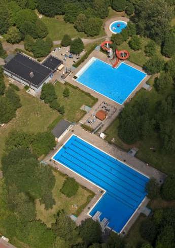
By loading the card, you accept Google's privacy policy.
Learn more
By loading the card, you accept Google's privacy policy.
Learn more
By loading the card, you accept Google's privacy policy.
Learn more
The map shown here is provided by tourenplaner-rheinland-pfalz.de. This is a third party provider. tourenplaner-rheinland-pfalz.de uses Outdooractive. By loading the map, you accept the privacy policy of Outdooractive.
Learn more about Outdooractive | Tourenplaner-rheinland-pfalz.de
The map shown here is provided by tourenplaner-rheinland-pfalz.de. This is a third party provider. tourenplaner-rheinland-pfalz.de uses Outdooractive. By loading the map, you accept the privacy policy of Outdooractive.
Learn more about Outdooractive | Tourenplaner-rheinland-pfalz.de
The map shown here is provided by tourenplaner-rheinland-pfalz.de. This is a third party provider. tourenplaner-rheinland-pfalz.de uses Outdooractive. By loading the map, you accept the privacy policy of Outdooractive.
Learn more about Outdooractive | Tourenplaner-rheinland-pfalz.de
The map shown here is provided by tourenplaner-rheinland-pfalz.de. This is a third party provider. tourenplaner-rheinland-pfalz.de uses Outdooractive. By loading the map, you accept the privacy policy of Outdooractive.
Learn more about Outdooractive | Tourenplaner-rheinland-pfalz.de
The map shown here is provided by tourenplaner-rheinland-pfalz.de. This is a third party provider. tourenplaner-rheinland-pfalz.de uses Outdooractive. By loading the map, you accept the privacy policy of Outdooractive.
Learn more about Outdooractive | Tourenplaner-rheinland-pfalz.de


The map shown here is provided by tourenplaner-rheinland-pfalz.de. This is a third party provider. tourenplaner-rheinland-pfalz.de uses Outdooractive. By loading the map, you accept the privacy policy of Outdooractive.
Learn more about Outdooractive | Tourenplaner-rheinland-pfalz.de

The map shown here is provided by tourenplaner-rheinland-pfalz.de. This is a third party provider. tourenplaner-rheinland-pfalz.de uses Outdooractive. By loading the map, you accept the privacy policy of Outdooractive.
Learn more about Outdooractive | Tourenplaner-rheinland-pfalz.de

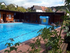
By loading the card, you accept Google's privacy policy.
Learn more
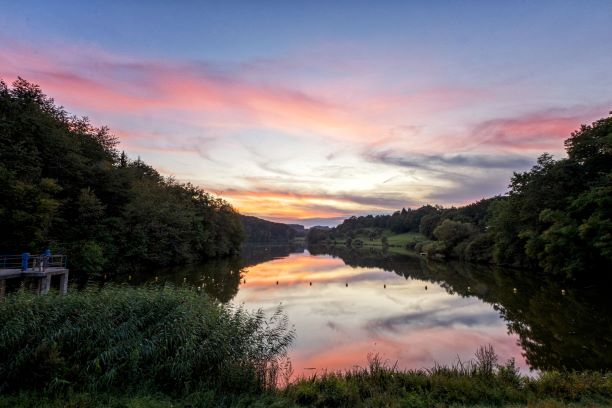
By loading the card, you accept Google's privacy policy.
Learn more